Wildfire spotted from space as helicopter brought in to tackle blaze

 Planet Labs PBC
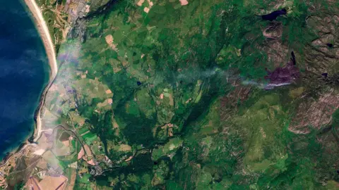
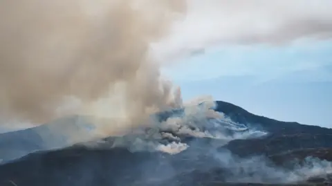
Satellite images have captured plumes of smoke and damage caused by a wildfire in north Wales.
Data gathered by BBC Verify suggests an estimated 951 hectares (2,350 acres) of the Rhinogydd mountains in Gwynedd have been burned by a wildfire which broke out earlier this month.
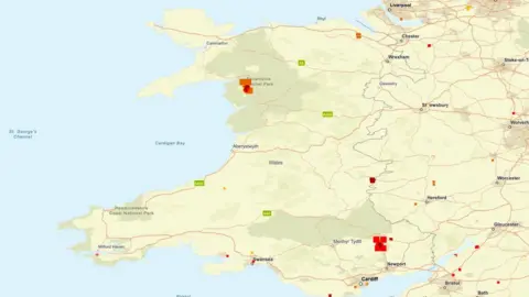
Nasa's satellite-based FIRMS monitoring system has also detected heat signatures from four areas of Wales where wildfires have broken out.
It is showing heat sources at Blaenavon in Torfaen, Presteigne in Powys, and Pentre Halkyn in Flintshire.
Natural Resources Wales said a specialist firefighting helicopter will be deployed to Rhinogydd on Friday morning after calls for "aerial support".
 Pat O'Neill
On Wednesday the Welsh government activated "crisis management arrangements" to tackle the wildfires that have broken out across Wales.
NRW said: "While the helicopter is being deployed to support the response in the Rhinogydd, its availability will continue to be assessed in line with operational needs across Wales and the wider UK.
"Should other fire and rescue service require aerial support for incidents in their area, we will remain in close contact to understand those needs and consider how best to assist alongside partner agencies."
In north Wales, the first signs of the fire from the Rhinogydd mountain were visible in satellite images from 13 July.
Members of the public have been urged to avoid areas affected by the wildfires, after reports that some people who travelled to them needed emergency rescue assistance.
Ch Insp Ian Roberts, of North Wales Police, said ignoring road closures and police cordons was "dangerous and may constitute a criminal offence".
"Anyone entering restricted areas or failing to follow police directions could be subject to enforcement action," he added.
Siân Gwenllian, cabinet minister for local government, housing and planning, said the fires at Rhinogydd and Blaenavon were the most "significant wildfire incidents in Wales".
She said: "Both remain active and are being managed reflecting the efforts of those involved.
"Other wildfires have been successfully brought under control and are now being monitored and dampened down - demonstrating both the hard work, expertise and professionalism of our fire service."
 Getty Images
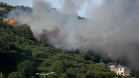
On Thursday night, emergency services said they were aware of a fire on Kilvey Hill in Swansea.
Anyone nearby should keep their windows and doors closed due to the smoke, they warned.
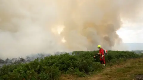
Meanwhile, smoke from the fire at Blaenavon, which covers 220 hectares (543 acres), has travelled as far as Cardiff.
Gwenllian said the blaze was "currently the priority for ground operations" as firefighters and NRW remain on site in "challenging conditions".
She added the fire had "produced a significant amount of smoke", but officials confirmed there was "currently no threat to life or property".
"The fire is expected to continue burning for several days, and firefighters remain at the scene to prevent it spreading further and putting lives, wildlife and property at risk," she said.
South Wales Fire and Rescue (SWFR) said the Met Office anticipated the plume of smoke will settle lower overnight, after being sent east towards Newport earlier on Thursday.
 Nasa Firms
Residents said the smoke had caused a "fogginess" and "acrid smell" stretching for several miles between Torfaen and Pontypool.
SWFRS warned residents to keep windows and doors closed, and advised commuters to switch air conditioning to recirculation mode in their vehicles.
The fire service said it had cut a full perimeter line around the incident.
"This offers a line of protection with the aim of keeping the incident contained, supported by two additional water bowsers from partners and contractors," it said.
North Wales Fire and Rescue Service said crews continued to monitor the situation in Capelulo, near Sychnant Pass, in the wake of a large grass fire on Conwy Mountain.
Elsewhere, firefighters have tackled fires at Hope Mountain and Brymbo, in Wrexham county, Pentrefelin, Holyhead, and Pentre Halkyn overlooking the A55 in Flintshire.
The fire service said they were continuing to oversee conditions as a precaution, with teams from Mid and West Wales Fire Service on hand to help.
 South Wales Fire and Rescue Service
Mid and West Wales Fire Service said it was tackling a blaze about the size of 120 football pitches - 90 hectares - in the Presteigne area on Thursday morning.
It added that crews were monitoring hotspots in the fire at Hanter Hill, in Gladestry, Powys.
Additional reporting by Alex Murray, BBC Verify